Remember this guy? 
He was exploring a city in Egypt called Tanis to find an artifact to steal before the Nazis could. Today he’d be called a looter.
Well Tanis is a real place, a huge vanished city that is in the northeastern Nile Delta: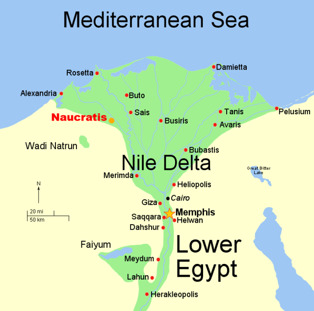
Here’s a Google Earth view of the area:
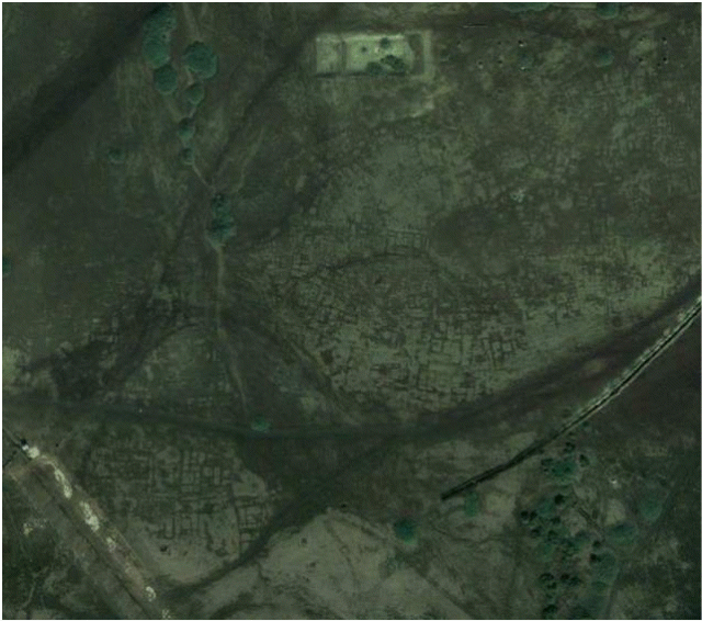
You can see the buildings and tombs, streets and alleyways, in crop marks but in this visible light image you can see only a hint of the huge city that once occupied the area.
It is presently being excavated by teams of archaeologists from France, the USA, and Egypt but at ground level only a few randomly placed stones and broken obelisks are visible:


But Dr. Sarah Parcak, an Egyptologist at the University of Alabama, Birmingham has been looking at it from 700 km (435 miles) above and has discovered thousands of buildings and structures and a virtual map of the city of Tanis.
I saw Dr Parcak being interviewed by Stephen Colbert on the Late Show 
(Watch the very entertaining interview here.)
Excited and intrigued by this I explored further and found this detailed image created using infra-red filters over satellite images.

She has discovered thousands of ancient sites in Egypt, from pyramids to the detailed street plan of the city of Tanis.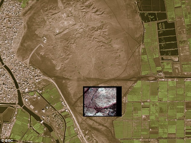
She says she was amazed at how much she and her team has found and stands amazed at the exponential rate technology is improving. “It’s getting much better, much faster. High-resolution satellite images will soon portray objects less than one foot in size. There’s even an aircraft sensor system that sends down hundreds of thousands of pulses of light measured at different return rates. It allows you to literally strip away vegetation and see entire cities beneath the rain forest canopy. This is the unbelievable future of archaeology.”
“It just shows us,” she adds, “how easy it is to underestimate both the size and scale of past human settlements.”
More than 1,000 tombs and 3,000 ancient settlements were also revealed by looking at infra-red images which show up underground buildings due to the differing densities between the rather dense mud-bricks used in Ancient Egypt in building construction and the typically less dense surrounding sands or soils under which mud brick building foundations may often now lay buried. The cameras on the satellites are so powerful they can spot objects of less than a meter in diameter.
As mentioned in the Colbert interview, Dr Parcak has been awarded the TED prize of $1,000,000.00. Watch her equally fascinating TED Talk.
And I’m guessing there’s another advantage to working long hours in a lab in Birmingham, fewer of these encounters:

