On February 8, 2016, the Visible Infrared Imaging Radiometer Suite (VIIRS) on the Suomi NPP satellite captured several images of blooming phytoplankton and swirling currents along the coast of California and western Mexico.
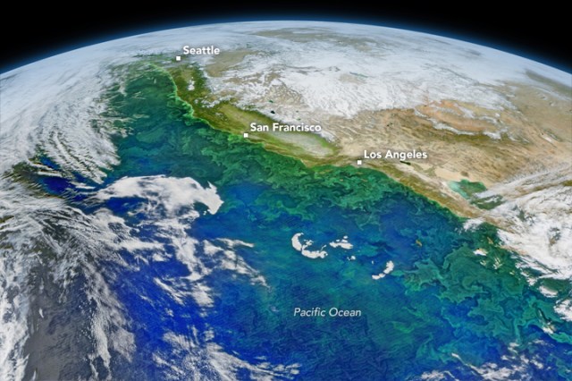 The images were stitched together into a composite built with data from the red, green, and blue wavelength bands on VIIRS, along with chlorophyll data. A series of image-processing steps highlighted the color differences and subtle features in the water.
