
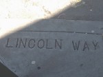
This is my first Google map, San Francisco’s macabre 2 mi (3.2 km) long ‘Assassination Trail.’ Starting at the Baker St end of the Panhandle and ending at 7th Ave & Lincoln way it traces a route past places and things associated with 6 people who were murdered in the US.
Follow it at this interactive map:
https://www.google.com/maps/d/edit?mid=z-wrLPRhxeo8.ksxxMO5WlnDY
-
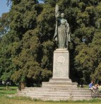
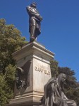
- William McKinley monument
-
- Killed by an anarchist
-
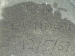
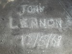
- John Lennon wrote his name here on May 12, 1969
-
- Killed by a maniac
-
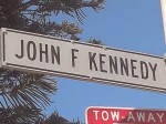
- JFK
-
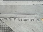
- Killed by the CIA & Mafia
-

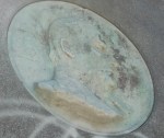
- James A Garfield
-
- Killed by a disgruntled office seeker
-

- Dr Martin Luther King
-
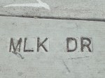
- Killed by a racist asshole
-
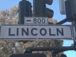
- Abraham Lincoln
-
- Killed by a lousy actor and loser
-
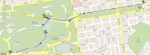
- The 2 mile route
